09/08/2017: What budget cuts would mean for predicting severe weather

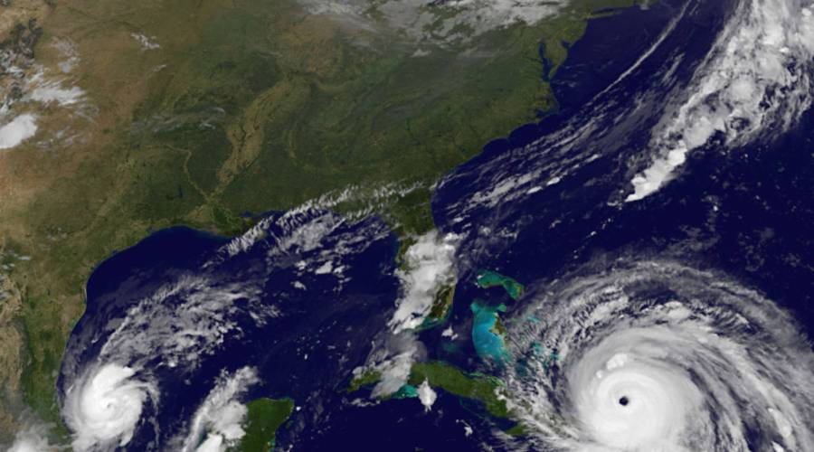
Hurricane Irma is a Category 5 storm that made landfall in the Caribbean this week and may hit Florida this weekend. The National Weather Service uses National Oceanic and Atmospheric Administration satellite images to get a sense of how strong the storm is and where it’s going. However, the Trump administration is proposing budget cuts to those agencies. We discuss the critical images NOAA is capturing and what would happen if meteorologists received degraded satellite imagery.
Hurricane Irma is a Category 5 storm that made landfall in the Caribbean this week and may hit Florida this weekend. The National Weather Service uses National Oceanic and Atmospheric Administration satellite images to get a sense of how strong the storm is and where it’s going. However, the Trump administration is proposing budget cuts to those agencies. We discuss the critical images NOAA is capturing and what would happen if meteorologists received degraded satellite imagery.
The future of this podcast starts with you.
Every day, the “Marketplace Tech” team demystifies the digital economy with stories that explore more than just Big Tech. We’re committed to covering topics that matter to you and the world around us, diving deep into how technology intersects with climate change, inequity, and disinformation.
As part of a nonprofit newsroom, we’re counting on listeners like you to keep this public service paywall-free and available to all.
Support “Marketplace Tech” in any amount today and become a partner in our mission.


