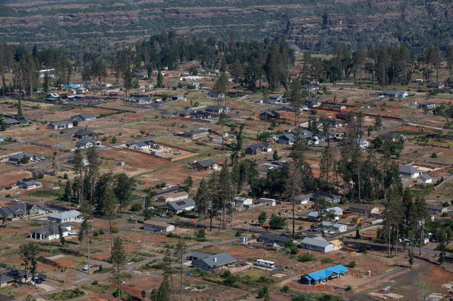
Technology, community, insurance: How California hopes to mitigate future wildfires

Wednesday marks five years since the deadliest fire in California history.
In one morning, the Camp Fire sparked on power lines belonging to the utility PG&E, killing at least 85 people and destroying 90% of homes in the town of Paradise.
Fire survivor Karen Gowins said the town is being rebuilt, but a lot more slowly than she’d hoped.
“People are trying to get stuff in, desperately, but there are still people living in trailers and camping out. Going back to Paradise before the fire is going to be very, very difficult, if not impossible,” Gowins said.
The scale of destruction from Camp and other catastrophic fires left a lot of people wondering how to stop the next one, or at least slow it down, even as year after year the fires keep happening.
Back in 2020, I took a ride on an e-bike through the Moraga-Orinda Fire District, just north of Oakland. Chief Dave Winnacker showed me around the area, where a lot of the landscape is at risk of fire.
We stopped at one point to meet John Kotowski, whose home is situated on a hill in the district.
“Look where we live. There’s 6,800 acres behind us, and that’s part of 22,000 acres, and if a fire starts there, it’ll come up here real fast,” Kotowski said. “And thanks to David’s work, we’ve bought a little time to get out. Maybe save houses, maybe keep it from going into Orinda as a whole.”
Kotowski was effectively a liaison with the fire district, encouraging neighbors to have their homes audited for fire risk.
“Things like close up their decks so that’s not a fire hazard, trimming around the houses, cleaning up brush and anything that we can do to make this a safer place,” Kotowski said.
While important, auditing individual properties in person isn’t all that efficient.
For a long time, Winnacker has been convinced that smartphones — what he likes to call “that supercomputer in our pockets” — can help communities protect themselves from fire.
Since I last saw him, he’s been developing an app with partners that models how a potential fire might spread into a neighborhood so they can focus on high-risk areas.
“The next step is to go to the parcel level, where we want to understand what the conditions are on a parcel,” Winnacker said.
Instead of relying solely on inspectors going door to door, a resident takes photos of their home, uploads them onto the app and then the resident gets a list of what needs to be removed and an explanation of why.
The technology is being pilot tested in five communities in Northern California. The town of Paradise, where the Camp Fire happened, is one of them.
Winnacker believes that if enough people in a community do this work together, they can buy crucial time for firefighters in the event of a fire.
But how to get entire communities to get on board? Insurance holds some answers.
Across the western U.S., there are an estimated 44 million properties in high-fire-hazard areas. Insuring those homes has become really expensive.
When Karen Gowins said that a lot of people haven’t come back to the town of Paradise, the high cost of insurance is part of the reason. In California, some major carriers have stopped renewing home insurance for residents. And others have stopped writing new policies.
“Once we started having major wildfires, there became much more of an urgency for insurance companies to move out of the more risky, least adequately priced areas,” according to Nancy Watkins, a principal at the actuarial and risk-management company Milliman.
Rates weren’t matching the risk, according to Watkins, so she teamed up with Chief Winnacker in Orinda, among others, to fill the information gap.
“Some of the things that we found out were not readily available were the current state at the parcel and community level, right around the house, things that are difficult to measure using satellite imagery,” Watkins said.
And it’s the kind of technology Winnacker talked about that gets detailed information “at scale” without depending so much on in-person inspections done one home at a time.
“What if models were able to show us how much the risk had been reduced by steps that the communities took?” Watkins said.
She believes good data and technology that helps to gather it is key and could eventually drive insurance rates down for homeowners.
At the same time, change is coming to how insurers can model risk in California.
Last month, the state said it would start allowing insurance carriers to use what’s known as catastrophe modeling, which incorporates global warming’s impact on the climate, as they set rates.
“They won’t have this backwards-looking formula that, frankly, hardly anyone can defend that it produces the right answer,” Watkins said.
Watkins said that could ultimately be a good thing for the consumer.
The future of this podcast starts with you.
Every day, the “Marketplace Tech” team demystifies the digital economy with stories that explore more than just Big Tech. We’re committed to covering topics that matter to you and the world around us, diving deep into how technology intersects with climate change, inequity, and disinformation.
As part of a nonprofit newsroom, we’re counting on listeners like you to keep this public service paywall-free and available to all.
Support “Marketplace Tech” in any amount today and become a partner in our mission.


